Scheme area
We welcome feedback from local people to support changes to anywhere in Beckton as outlined in the project area map. We are particularly interested in making improvements for walking and cycling in the focus areas.
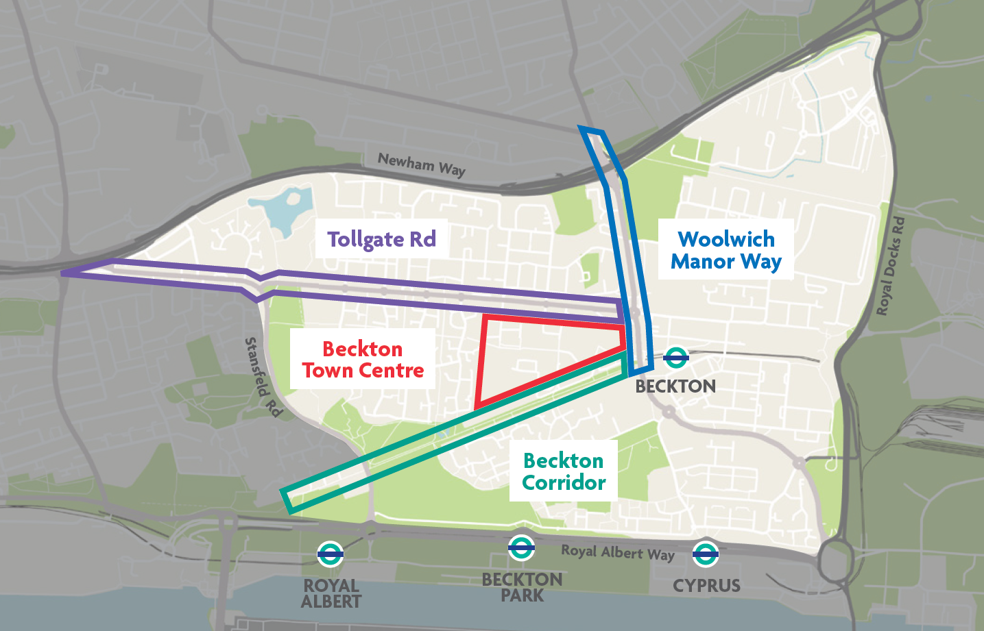
Focus areas
Beckton Town Centre
Beckton Town Centre is a hub of activity that includes access to transport including Beckton DLR station and Beckton bus station. However, we recognise that it can be a challenging environment for people to move around, particularly by walking and cycling.
The scope of potential improvements to walking and cycling includes access to and through the wider Asda shopping area.
This is a focus area for the Becton Walking and Cycling project because the Levelling Up Funding is about both movement of people as well as connecting people to opportunities within town centres.
Tollgate Road
Tollgate Road is a key east-west corridor, which runs through the Beckton area and supports access to residential, community, and commercial destinations.
We acknowledge that it can be a difficult environment for walking and cycling, including the speed and volume of traffic, junctions, and crossing the road.
Woolwich Manor Way
Woolwich Manor Way connects East Ham High Street South, the Greenway, the northern end of Cycleway 3, and Beckton Town Centre.
It is particularly significant because it forms the only major north-south connection across the A13 within the project area. The nearest alternative crossings are half a mile away each direction, and are for pedestrians bridges only.
Beckton Corridor
Beckton Corridor is a key pedestrian route, separated from car traffic, that connects Beckton DLR station to residential areas, Beckton Park, and Royal Albert Way (including Royal Albert DLR station). It forms part section 15 of the Capital Ring, a 78-mile orbital walkway consisting of open space, nature reserves, and Sites of Specific Scientific Interest.