Leaway Path
A riverside walking and cycling route linking neighbourhoods, parks and the Thames
Vision
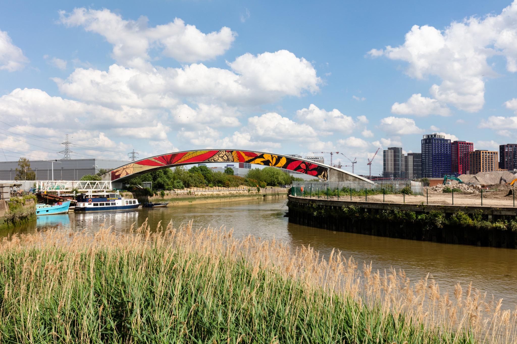
The Leaway Path is the backbone of the wider Lea River Park, a long-term project to transform the Lower Lea Valley into a connected sequence of high-quality riverside spaces. The vision is to create a continuous, welcoming walking and cycling route from Queen Elizabeth Olympic Park to the River Thames, linking existing and new open spaces, heritage destinations and neighbourhoods along the River Lea.
Over time, the Leaway Path will help stitch together places that have historically felt separated by the river, major roads and industrial land, making it easier for people to access nature, culture, jobs and public transport on foot or by cycle. It is also intended to strengthen the Lower Lea Valley’s identity, celebrating its distinctive landscapes, industrial heritage and wildlife, while supporting greener, healthier everyday journeys.
The Lea River Park vision combines:
- Connectivity – easier, safer walking and cycling routes along the river and better links between communities on both sides
- Biodiversity and greener places – enhanced habitats, greener corridors and improved access to riverside nature
- Culture and local character – integrating arts, heritage and wayfinding to create a distinctive place and a “day out” destination as well as a practical everyday route
- Incremental delivery – a route that grows as land becomes available and as regeneration progresses, guided by shared design principles so it feels coherent over time
Delivery so far
Work is already underway, through a combination of public investment, partnership working and development-led delivery, to make the Leaway more continuous, accessible and engaging.
1. Connectivity improvements
Key access upgrades have helped people reach the riverside more easily and begin to overcome severance, including:
- Twelvetrees ramps improving access and routes around the river corridor
- A13 / Canning Town ramp connections improving links at a major barrier point in the network
To learn more about future connectivity in the Lower Lea Valley, see Lower Lea Valley Bridges.
2. Culture, art and community activity
Newham has been working with The Line, London’s public art walk, to enhance the experience of walking and cycling along the river. This has included:
- Public art installations along the route
- A programme of community engagement, including activities such as walks and workshops, helping more people discover and enjoy the riverside environment
- Work to improve the route experience through creative wayfinding and placemaking
You can explore The Line and plan a visit here: https://the-line.org/
3. Opening new riverside paths through regeneration
As development comes forward in the Lower Lea Valley, the Leaway Path is being delivered in stages, with new or improved public riverside routes secured through the planning process. This helps extend and “stitch together” the route over time, creating a more continuous riverside walk and cycle connection as regeneration progresses.
What happens next
The Leaway Path will continue to grow through a mix of:
- Further riverside links and access improvements
- Ongoing public realm and biodiversity enhancements
- Continued partnership work to bring forward culture, art and wayfinding
- Future development phases that deliver additional public riverside access and route continuity
As plans progress, there will be opportunities for residents, businesses and local organisations to stay informed and help shape priorities, so the Leaway becomes both a valued everyday route and a destination that reflects the character of the Lower Lea Valley.